DR Solutions

Blog

Evacuating During a Hurricane

Before a Storm . . .

Before a storm even threatens your area, there are some things that you should do to be prepared and not have to make snap decisions in the middle of a storm.

Learn How Long it Takes to Evacuate From Your Area

Your local or county Emergency Management office can help you determine a rough estimate of how long it will take you to get out of your area and to safety. This time is critical to know so that you aren’t stuck in the storm before you can get to safety. This should be a time in hours before you are stuck sheltering in place.

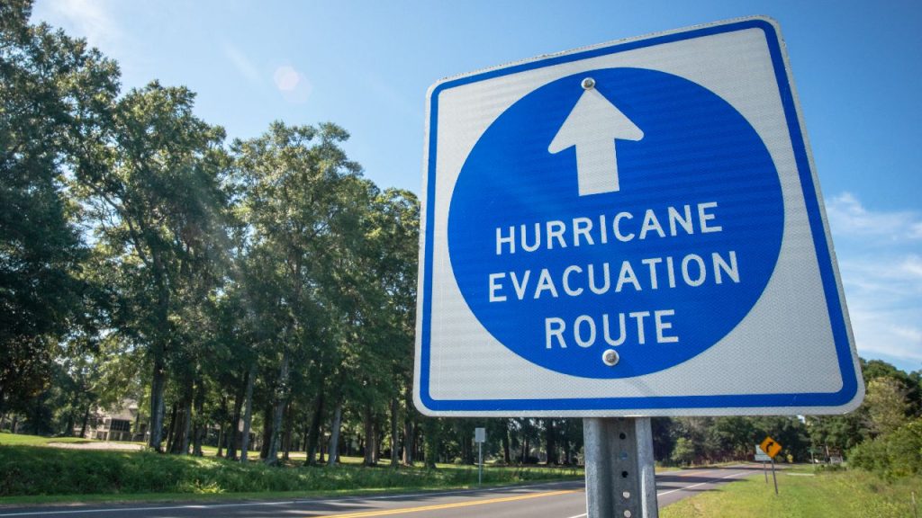
Pick Routes Out of Your Area

Choose at least three routes out of your area, all going in different directions (e.g. North, South, East). These routes should be along trafficable roads that will not likely be shut down too early prior to landfall. Keep in mind that backroads may be hampered by fallen trees. Also keep in mind that as soon as winds reach 30 – 35 mph, some roads and most bridges will be closed. EMS will also likely stop responding to calls until the storm passes. Map out the rout with landmarks or specific exits along the way. This will also help in coordinating or informing family members as to you current location.

When choosing routes, keep in mind that some states (like Florida) will enact a Counter Flow traffic on interstates and major highways. This is where all traffic lanes will be ONLY used for traffic moving AWAY from the storm. There may be one or two lanes left for traffic moving TOWARDS the storm such as responder vehicles and response assistance coming in from out of the area.

Make an Evacuation Plan

Now is the time, before a storm is threatening, to make a plan for any evacuations. Put the routes you have decided on and include the landmarks and waypoints you created in the previous section. Also include whom you will contact in case you decide to evacuate or are ordered to evacuate. This should be someone that all of your family knows is your central contact and can keep everyone updated on your situation. Also include the criteria you will use to determine when the latest time you can evacuate will be. For example, “I will evacuate no later than (NLT) 12 hours before tropical storm force winds (39 mph) are expected to reach my area”.

Also, research your home’s flood planes and storm surge categories so that you know what level of storm may affect you. You can get this information from your local or county Emergency Management office.

When a Storm is Approaching . . .

When a storm is approaching and has ANY chance of affecting your area, it is time to put your plan into action.

Stay Informed

Monitor the storm information and note when the winds for your area are expected to reach your “trigger” wind speed. Start packing for a 3 – 7 day stay somewhere else. Notify your central contact person that you are making preparations to possibly evacuate. Know what the expected storm surge and flooding will be for your area and when that is likely to occur. Note that flooding may occur during the heavy rains preceding the storm and will likely be exacerbated by the storm surge.

Prepare to Evacuate

Well before the storm is a threat, you should start making preparations to leave. Fill up your gas tanks (all vehicles), pack your evacuation bag, take enough medications with you for at least 7 days. If you have children, identify any favorite toys, games, or stuffed animals that will help them cope.

Based on the path of the storm, you may need to alter one of your routes slightly to make it safe. You should evacuate at a right angle to the storm in a direction that can get you at a safe distance.

Also, this is a good time to look at the shelters that are opening in your area as a backup plan to evacuating. If you have pets, make sure to identify the closest Pet Friendly shelter. Pet friendly shelters will NOT take care of your pet for you. They will only have facilities to house them. You will need to bring your own food, toys, blankets, and usually you own cage or travel crate. You will also have to feed them and walk the when needed. Make sure to have small bags to pick up any messes.

Know When the Storm Will Make Landfall and Where

Monitor the storm’s track and keep an eye on the Storm Surge, Hurricane, and Tropical Storm Watches and Warnings.

TypeWatchWarning
Tropical Storm48 hours before 39 mph winds36 hours before 39 mph winds
Hurricane48 hours before 74 mph winds36 hours before 74 mph winds
Storm Surge48 hours before inundation36 hours before inundation

Remember that the storm track is just an estimate of where the storm might go in the next few days. the further the prediction moves into the future, the less precise the predicted path will be. Don’t just look at the white ice cream cone to determine if it will threaten you, look on both sides of the path to see if it will even come close.

Know the Expected Flooding and Winds in Your Area

Using the watches and warnings and any flooding predictions, determine how much flooding you will possible see. Also try to get an idea what wind speeds you will see in your area. All of this information will help you to determine if you can shelter in place or you need to evacuate. If you are ordered to evacuate by your local or county Emergency Management office, evacuate. Otherwise you will likely be under water and EMS will not be able to respond for possibly days.

Before It’s Too Late . . .

Using your evacuation plan and the current and predicted situation, determine when your NLT time is for you to safely be able to evacuate. It is a good idea to give yourself a few hours buffer so that any unforeseen circumstances (they WILL happen) don’t put you behind the curve and force you to pull off somewhere and ride out the storm..

Know the Traffic Situation and How Long It Takes to Get Out

If there are more people than trying to evacuate the area, your evacuation time will likely be extended. Listen to the newscasts for congested evacuation routes. You may have to alter your planned routed based on congestion and roads or bridges that are unusable. If you live in an area where you have to cross a bridge to get out to safety, you should plan to evacuate WELL before normal to make sure the bridges are usable when you leave.

Pick a Route and Destination

Remember, the best route to evacuate on would be at a right angle to the path of the storm. For example, if the storm were moving North towards your area, you should evacuate to the East or West depending on which can get you to a safer distance, If the storm is moving to the East or West, you should evacuate to the North or South. Understand that as a hurricane approaches land, it will possible be drawn to the land and change its course slightly, veering towards the land. If a storm is approaching from the south and is passing close to land, you may need to have a route that is a little more Southeast.

Also have a planned destination in mind. Don’t just evacuate. If you know you will be evacuating, you can try to make hotel or motel reservation well in advance or coordinate with a friend or relative. Don’t just evacuate into the path of the storm.

L E A V E ! ! !

When you reach your trigger time, and preferably well before, if you are evacuating or are ordered to do so, LEAVE. You should have been preparing to go well before this time and delaying will only put you in possible danger.

If circumstances make it so that you cannot safely evacuate, this is the time to go the the shelter in your area that you researched.

Effect of El Niño and La Niña


What Are El Niño and La Niña

El Niño and La Niña are both effects of the El Niño Southern Oscillation (ENSO) cycle. About every 3-5 years, the surface temperatures in the Pacific equatorial region fluctuate to the point where the temperatures are either above the average (El Niño) or below the average (La Niña). A long time ago, fishermen in South America noticed the warmer Pacific water temperatures that peaked around December. They named it El Niño de Navidad which was shortened to just El Niño (the little boy) later. La Niña (the little girl) is just the opposite and is marked by a period of colder waters in the Pacific equatorial region.

El Niño

El Niño Pattern (https://oceanservice.noaa.gov/facts/ninonina.html)

El Niño weakens the trade winds which pushes the warmer waters to the east causing the warming of the Pacific waters which in turn causes the jet stream in the Pacific to move south of its normal position. This movement causes the northern US and Canada to experience warmer and drier weather than normal. It also causes the southern US to experience warmer and wetter weather than normal.

La Niña

La Niña Pattern (https://oceanservice.noaa.gov/facts/ninonina.html)

La Niña strengthens the trade winds pushing the warmer waters to the west. This pushing of the waters to the west causes the colder water to be drawn up from deeper in the Pacific causing a cooling of the eastern Pacific. This cooling pushes the jet stream to the north causing wetter weather in the northern US and Canada and warmer, drier weather in the southern US. Sometimes the La Niña conditions will even cause widespread drought in the southern US. La Niña also causes ideal conditions for the formation of tropical cyclones.

El Niño to La Niña Transition

The transition from El Niño to La Niña usually predicts a busier hurricane season than normal. As the gap between the end of El Niño and the beginning of La Niña shrinks, the intensity of that season is predicted to increase. The 2024 season was one of those events.

Resources

What are El Niño and La Niña?
El Niño & La Niña (El Niño-Southern Oscillation)
El Niño/La Niña Information
Make a Plan, Get a Kit, Stay Informed


Being prepared for a disaster is much like practicing a drill or studying for a test. We prepare by learning ahead of time what we need to know and then just executing it when it is needed. This article will help identify the things that need to be accomplished in order to be “prepared”. We will look at making an Emergency/Disaster Plan, putting together a Disaster GO Kit, and Staying Informed of developing situations where we may need to react.

Make a Plan

Family members may not, and in some cases will not, be together when an emergency situation arises. There needs to be a plan that identifies where you will get together, how you will communicate, and what you plan to do in different emergencies.

Household Information

You will need to document your home information such as address, phone number, and possibly directions that a younger child can give to a public safety official.

Family Members

You include a list of your family members in the home and their contact information. You should also include those locally that may need to be contacted in an emergency. You should also have the contact information for a friend or family member out of state that can be a contact hub if communication locally is difficult or impossible. Include contact information for things like e-mail addresses, Facebook, or other social media sites. If family members have any specific medical or other issues that might require special handling, include those as well. Some examples would be wheelchair, oxygen, hearing aids, etc. Don’t forget to include any pets, relatives, or other boarders living with you.

Emergency Information

Include emergency contact information for schools, work, and other places of business that are visited frequently such as a gym, church, or recreation center. This should include a physical address and possibly directions, phone numbers, contact person, website, and possibly any pre-planned pickup or other emergency actions taken by the location.

Emergency Contacts

Make a list of people and locations that you might need to contact for assistance during or immediately after an emergency. This should include any and all methods of contacting them to include phone numbers, cell phone numbers, physical addresses, e-mail address, websites, Facebook, etc.

Threat Types

Try to identify what types of disasters or emergencies you might face in your area and have a plan for each type. Include whether you will stay or leave or make that call when it happens. If you might be dispersed geographically, determine a few meeting locations where you can gather the family and a way to let everyone know which location to meet at. Include directions to each place and an alternate location if the chosen location is inaccessible.

Medical Information

Include any doctors, hospitals, or other medical facilities that you might need to use or contact. Also include any medical conditions that might be exacerbated by or made more difficult by a disaster situation. Include lists of prescriptions take by each family member and any special medical equipment that needs to be taken. Make sure to document any allergies that family members might have along with the typical reaction. Include any emergency medications such as epi pens, etc. For pets, include the veterinarian information for each pet.

Insurance Information

Include all home owners, health, auto, and life insurance policies along with the carrier name and contact information and what, and who, they cover. Include the policy number and expiration dates of coverage.

Resources

You can go to the Red Cross or FEMA to get a “fill in the blank” type form to make your Family Emergency Plan from the links below:

FEMA “Make a Plan” Form
Red Cross Plan Template
Red Cross “Make a Plan” site

Get a Kit

When a disaster hits, you may be able to stay home or you may have to evacuate. A lot of the time when you evacuate you don’t know ahead of time where you can evacuate to. You need to be able to provide for yourselves for a short time and have on hand what you need to be successful. You can put your “GO Kit” contents into a backpack, bucket, tote, or even a rollable foot locker depending on the size needed. Backpacks are good for children to have to take their individual personal supplies. Buckets and totes are good for older children and adults to carry individual personal items. A larger rollable foot locker might be used to carry family supplies. The list below and in the Resources section can help you identify what you might need to include in these GO Kits.

GO Kit Contents

GO Kits should be individualized for each person since no list will be all inclusive for what everyone needs. The contents are broken down into categories.

Disaster Supplies

This would include items like flashlights, batteries, radios, large trash bags, moist towelettes, a small tool kit, and other items you might need. Also include a cell phone and multiple chargers. Keep everything small and compact. Remember you have to carry this with you. Many places you might evacuate to will not have any type of bedding. Even shelters that provide a cot will often not have sheets or even a pillow. Bringing your own bedding, even a sleeping bag, is advisable.

Emergency Supplies

This would include a first aid kit, hygiene supplies like soap, disinfectant, medications, etc. Include contact lenses, eye glasses, and the cleaning/care supplies for them. Always have at least one pair of eye glasses incase something goes wrong with the contact lenses.

Food and Water

Take enough water to have roughly 1gal / day for each family member. Some of this can be water bottles that are included in the individual kits. Food should not require much in the way of preparation. MREs normally have a heating pouch in them and are a good choice. Also carry snacks and other non-perishable foods that can be eaten without any preparation.

Resources

FEMA Build a Kit site
Red Cross Survival Kit site

Stay Informed

Now that you are prepared for emergencies, you need to stay informed so that you know when an emergency is coming or has happened. The best ways are to sign up for your city’s and county’s alert e-mails and tests. For weather related emergencies you can get a weather alert radio that will sound an audible alarm when an emergency exists with the weather. Always keep an ear out for any news of developing situations so that you can plan and be prepared.

Other Resources

FEMA and non-profit organizations like the American Red Cross, The Salvation Army, or DR Solutions have numerous resources and training courses that will help prepare you for emergencies and disasters.

FEMA
The American Red Cross
The Salvation Army
DR Solutions
2024 Season, a Look Back
Hurricanes Florence, Helene, and Isaac during the 2024 season.


The 2024 hurricane season for the Atlantic was a very busy one. Initial predictions in MAY, 2024 were that we would see around 23 Named Storms with 11 Hurricanes and 5 Major Hurricanes. Predictions were adjusted when the Atlantic Ocean experienced a Saharan Air Layer (SAL) which calmed the activity for most of the month of July. A SAL is a layer of dust that comes off of the Saharan desert, Morocco in this case, and creates a dampening effect on storm formation in the Atlantic (see image below).

Saharan Air Layer.

The season had one of the slowest starts since 2014 with the first named storm, Alberto, not forming until 19 JUL. Alberto was followed, though, by Beryl which reached CAT 5 strength. Beryl was the earliest to reach CAT 4 and then CAT 5 in recorded history. The season had a pause in July but picked back up in early August with Debbie. August stayed fairly mild with only two named storms.

September activity picked back up with 6 named storms during the month which included Helene. Helene’s path took it along the gulf coast of Florida pushing water into the coastal areas and bringing damaging winds along the gulf coast. The widespread debris and flooding caused an issue when Milton, which had strengthened to the second CAT 5 in the season, was heading towards the same areas effected by Helene. Emergency debris clearance operations were started to minimize the amount of loose materials in the areas in order to mitigate damage from flying debris.

Sara was the final named storm of 2024 but it only made it to Tropical Storm strength. Overall, there were 18 Named Storms, 11 Hurricanes, and 5 Major Hurricanes in 2024, not much different from the predictions for the number of Hurricanes and Major Hurricanes. The 2024 season was the second most costly Atlantic hurricane season in history with over $227.3 billion in damages. The final tally will be well over that once the last of the assessments are processed and could put 2024 close to or more than the 2017 season which holds the top honors currently.

RankCostSeason
1≥ $294.803 billion2017
2> $227.3 billion2024
3$172.297 billion2005
4$117.708 billion2022
5≥ $80.827 billion2021
6$72.341 billion2012
7$61.148 billion2004
8$54.336 billion2020
9≥ $50.526 billion2018
10≥ $48.855 billion2008

In the end, the 2024 season saw 9 named storms, half of the total named storms, during the last 2 months of the season with 3 active storms at one point in time. A strong finish to a very busy season, even with a very quiet July and August.